Maritime Data Guide
Understanding AIS Data
A complete guide to the Automatic Identification System — the technology that powers modern vessel tracking and maritime intelligence.
TL;DR — AIS in 30 Seconds
- •AIS is a radio-based system where ships broadcast their position, speed, and identity every few seconds.
- •Terrestrial AIS covers coastal areas (50km from shore) with updates every 2-10 seconds.
- •Satellite AIS provides global ocean coverage with updates every few minutes.
- •800,000+ vessels worldwide are tracked via AIS under international maritime law.
What is AIS?
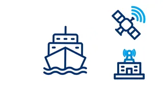
The Automatic Identification System (AIS) is a maritime tracking system that uses radio transponders on ships to broadcast vessel information. Originally developed for collision avoidance and maritime safety, AIS has become the foundation of modern maritime data and intelligence.
Every few seconds, AIS transponders automatically broadcast a vessel's identity, position, course, speed, and other navigation data. This information is received by other ships, coastal stations, and satellites — creating a comprehensive picture of global maritime traffic.
Under international maritime law (SOLAS), AIS is mandatory for all international voyaging ships of 300 gross tonnage and above, and all passenger ships regardless of size. This requirement means over 800,000 vessels worldwide are tracked via AIS.
How AIS Works
AIS transmits vessel data through a simple but powerful process.
1. Vessel Transmits
Ship's AIS transponder broadcasts position, speed, course, and identity on VHF radio frequencies
2. Signal Received
Coastal stations (terrestrial) or orbiting satellites capture the AIS signal
3. Data Processed
Raw signals are decoded, validated, and enriched with vessel database information
4. API Delivery
Clean, structured data delivered via REST API to your applications
Update Frequency by Vessel Status
2-10 sec
Vessel underway (terrestrial)
3 min
Vessel at anchor
~3-15 min
Satellite AIS (open ocean)
Terrestrial AIS vs Satellite AIS
Two complementary technologies work together to provide global vessel tracking coverage.
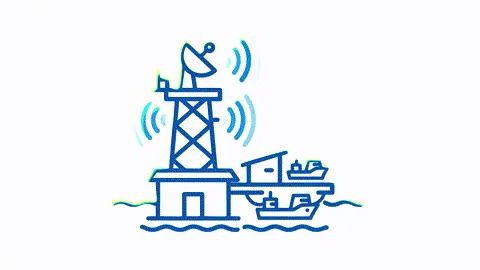
Terrestrial AIS
Shore-based receiving stations capture AIS signals from vessels within range (typically 50km). Provides high-frequency updates for coastal waters and port approaches.
- Near real-time updates (every 2-10 seconds)
- Ideal for port operations
- Limited to ~50km from shore
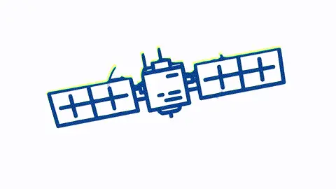
Satellite AIS
Satellites in orbit receive AIS signals from vessels anywhere on Earth, including the open ocean. Essential for tracking vessels beyond coastal coverage.
- True global ocean coverage
- Tracks vessels mid-ocean
- Updates every few minutes
| Aspect | Terrestrial AIS | Satellite AIS |
|---|---|---|
| Coverage | Coastal areas only (~50km from shore) | Global ocean coverage |
| Update Frequency | Every 2-10 seconds | Every few minutes |
| Best For | Near-shore tracking, port operations | Open ocean tracking, global coverage |
| Cost | Lower infrastructure cost | Higher but declining |
Satellite Plans Include Both Data Sources
Our satellite plans combine terrestrial and satellite AIS data automatically. We always serve the most accurate, recent position for every vessel — using high-frequency terrestrial data in coastal waters and satellite data in open ocean. You get the best of both worlds without managing multiple data sources.
View pricing plansVessel Identifiers Explained
Ships are identified by several different numbers. Understanding these identifiers is essential for working with maritime data.
MMSI (Maritime Mobile Service Identity)
A 9-digit number assigned to a ship's radio equipment. The first three digits indicate the country of registration (Maritime Identification Digits). Example: 211234567 (Germany)
Note: MMSIs can change if a vessel changes flag or radio equipment. Use IMO number for permanent identification.
IMO Number
A 7-digit number permanently assigned to a ship's hull by the International Maritime Organization. This number never changes, even if the vessel is renamed, reflagged, or sold. Example: 9876543
Best practice: Use IMO numbers when you need to track a vessel over time or across ownership changes.
Call Sign
A unique radio call sign assigned by the flag state. Used for voice communications. Example: ABCD1
Call signs can change if the vessel changes flag. Less commonly used for data purposes than MMSI or IMO.
AIS Data Fields
Here are the key data fields available in AIS transmissions and our API responses.
| Field | Description |
|---|---|
| MMSI | Maritime Mobile Service Identity - 9-digit unique vessel identifier |
| IMO Number | International Maritime Organization number - permanent vessel ID |
| Latitude/Longitude | Current vessel position coordinates |
| Speed Over Ground (SOG) | Vessel speed in knots |
| Course Over Ground (COG) | Direction of travel in degrees |
| Heading | Direction the bow is pointing |
| Navigation Status | Current operational status |
| Destination | Intended port of arrival |
| ETA | Estimated time of arrival |
| Draught | Depth of vessel below waterline |
| Ship Type | Vessel classification |
| Call Sign | Radio call sign |
AIS Data Use Cases
AIS data powers a wide range of maritime applications across industries.
Fleet Management
Track your vessels in real-time, monitor routes, and optimize operations with accurate position data.
Learn moreCommodity Trading
Monitor cargo movements, track shipments of oil, grain, and other commodities to inform trading decisions.
Learn morePort Operations
Manage berth scheduling, predict arrivals, and coordinate logistics with accurate ETA calculations.
Learn moreSupply Chain Visibility
Gain end-to-end visibility of maritime supply chains, reduce uncertainty, and improve inventory planning.
Learn moreMaritime Security
Detect suspicious behavior, monitor restricted zones, and identify vessels of interest for security applications.
Learn moreEnvironmental Monitoring
Track emissions, monitor compliance with environmental regulations, and support decarbonization initiatives.
Learn moreAIS Data Limitations
Understanding the limitations of AIS data helps you use it more effectively.
AIS Can Be Disabled
Vessels can turn off their AIS transponders, intentionally or unintentionally. This creates gaps in tracking data, particularly in areas with illicit activity.
Spoofing & Manipulation
AIS data is self-reported by vessels and can be manipulated. Fake positions, identities, or destinations may be broadcast. Data validation is essential.
Coverage Gaps
Terrestrial AIS only covers coastal areas. Satellite AIS has global coverage but with lower update frequency. Some remote areas may have delayed or sparse data.
Data Quality Issues
Human error in entering voyage data (destination, ETA, draught) is common. Static vessel information may be outdated or incorrect.
How We Address These Limitations
Our data pipeline includes validation checks, anomaly detection, and cross-referencing with vessel registries. We flag potentially spoofed positions and provide data quality indicators in our API responses.
How to Access AIS Data
There are several ways to access AIS data, depending on your needs and budget.
Public AIS Websites
Websites like MarineTraffic and VesselFinder offer free vessel tracking with limitations on historical data and API access.
- Basic vessel positions
- No API access
- Limited history
AIS Data APIs
API providers like Data Docked offer programmatic access to real-time and historical AIS data for integration into your applications.
- REST API access
- Historical data
- Scalable pricing
Raw Data Feeds
For high-volume users, raw AIS data feeds provide direct access to unprocessed AIS messages for custom processing.
- Full data control
- Requires infrastructure
- Higher cost
Not sure which option is right for you?
Compare AIS API providersFrequently Asked Questions
Common questions about AIS data and how it works.
What is AIS and how does it work?
What is the difference between MMSI and IMO number?
How often does AIS data update?
What is the difference between terrestrial and satellite AIS?
Is AIS data reliable?
Which vessels are required to have AIS?
How can I access AIS data via API?
Ready to Access AIS Data?
Start building with our maritime data API. Get real-time vessel positions, voyage history, and more.
New to APIs? Learn the basics in our What is an API? guide.
Need past vessel positions? Explore Historical AIS Data.
Comparing providers? See our AIS API comparison.