Maritime Data
Historical AIS Data
Access up to 2 years of vessel position history. Reconstruct voyages, analyze routes, investigate incidents, and power your maritime analytics.
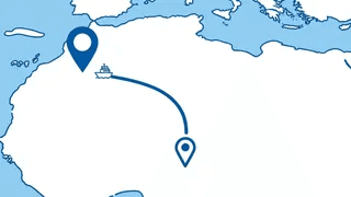
What is Historical AIS Data?
Historical AIS data is a record of past vessel positions, movements, and status information collected over time. While real-time AIS shows you where ships are now, historical AIS shows you where they've been.
Our historical track API provides access to up to 2 years of archived position data from our terrestrial AIS receiver network. This data is essential for voyage reconstruction, compliance audits, incident investigations, and maritime analytics.
Each historical record includes position coordinates (lat/lng), timestamps, speed, and course — everything you need to reconstruct how a vessel moved over time.
How Historical AIS Works
From data collection to your application — understanding the historical AIS pipeline.
1
AIS Broadcast
Vessels continuously transmit AIS signals containing position, speed, and identification data.
2
Reception & Storage
Our global network of AIS receivers captures these signals and stores them in our database.
3
Processing & Indexing
Raw AIS messages are decoded, validated, and indexed by vessel identifier and timestamp.
4
API Access
Query historical positions by IMO/MMSI and time range. Configure sampling intervals to match your needs.
Data Points Included
Each historical position record contains the following AIS-derived information:
Position: Latitude and longitude coordinates at each recorded point
Timestamp: UTC date and time of each position report
Speed: Vessel speed over ground (SOG) in knots
Course: Direction of travel (COG) in degrees
Heading: Direction the bow is pointing
Navigation Status: Underway, anchored, moored, etc.
Draught: Vessel draft indicating cargo load
{
  "imo": 9878530,
  "positions": [
    {
      "timestamp": "2025-01-15T08:30:00Z",
      "lat": 51.9089,
      "lon": 4.0518,
      "sog": 12.4,
      "cog": 245,
      "heading": 243,
      "nav_status": "Under way using engine",
      "draught": 8.2
    },
    {
      "timestamp": "2025-01-15T09:30:00Z",
      "lat": 51.8456,
      "lon": 3.8921,
      ...
    }
  ]
}
Technical Specifications
Data Retention
Up to 2 years
Historical position data available for query
Data Source
Terrestrial AIS
Coastal receiver network for high-frequency updates
Sampling Options
Configurable
From raw data to hourly summaries
Query Methods
By vessel or time range
Flexible API parameters for your use case
Use Cases
Historical AIS data powers critical applications across the maritime industry.
Voyage Reconstruction
Rebuild complete vessel journeys from port to port. Essential for voyage analysis, performance benchmarking, and understanding vessel movements over time.
Incident Investigation
Analyze vessel positions before, during, and after maritime incidents. Provides evidence for insurance claims, legal cases, and accident investigations.
Route Analysis & Optimization
Study historical routes to identify patterns, optimize future voyages, and reduce fuel consumption. Compare actual routes against planned passages.
Sanctions Compliance Audits
Verify historical vessel movements for compliance screening. Detect potential sanctions violations by analyzing port calls and ship-to-ship transfers.
Carbon Emissions Reporting
Calculate historical emissions based on actual vessel movements. Support IMO DCS, EU MRV, and corporate sustainability reporting requirements.
Market Research & Analytics
Analyze historical shipping patterns, trade flows, and port congestion trends. Build predictive models based on historical maritime data.
Historical vs Real-time AIS
Understanding when to use each data type for your maritime application.
Historical AIS
- ✓Voyage reconstruction and route analysis
- ✓Incident investigation and evidence
- ✓Compliance audits and due diligence
- ✓Historical pattern analysis
- ✓Emissions calculations
Real-time AIS
- ✓Live vessel tracking and monitoring
- ✓ETA predictions and arrival alerts
- ✓Fleet operations dashboards
- ✓Port congestion monitoring
- ✓Supply chain visibility
Ready to Access Historical Vessel Data?
Start querying historical AIS positions today. Up to 2 years of data available for any vessel.