Fleet-Scale API
Bulk Vessel Location API
Monitor your entire fleet with a single API call. Purpose-built for fleet operators, cargo trackers, and portfolio managers who need real-time visibility across multiple vessels.
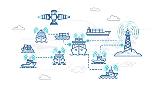
Terrestrial AIS coverage
750
Vessels/Minute
50
Vessels/Request
1 Credit
Per Vessel
99.9%
Uptime
Single vs Bulk: When to Use Each
Choose bulk when you need to track multiple known vessels efficiently. Choose single for satellite coverage or ad-hoc lookups.
| Aspect | Single Vessel API | Bulk API |
|---|---|---|
| Vessels per request | 1 | Up to 50 |
| Requests to track 50 vessels | 50 API calls | 1 API call |
| Rate limit | 100/min | 15/min |
| Max vessels per minute | 100 | 750 |
| AIS coverage | Satellite + Terrestrial | Terrestrial only |
| Credit cost | 1 per request | 1 per vessel found |
Built For
When you need visibility across your entire vessel portfolio
Fleet Dashboards
Update positions for your entire fleet in a single call. Perfect for real-time monitoring dashboards that need frequent updates.
Portfolio Monitoring
Track vessels in your cargo portfolio, charter fleet, or investment positions with efficient batch queries.
Supply Chain Visibility
Monitor multiple shipments simultaneously. Get positions for all vessels carrying your cargo in one request.
CRM & ERP Enrichment
Enrich your business systems with live vessel positions. Batch update customer records, shipment tracking, and logistics workflows.
Simple Integration
Pass comma-separated vessel identifiers, get positions for all of them in one response.
Request
GETBulk Location
GET /api/vessels_operations/get-vessels-location-bulk-search
    ?imo_or_mmsi=9465411,215767000,9321483
    &api_key=your_api_key
Response
200Bulk response with vessel data
{
  "total_requested": 2,
  "successful": 2,
  "failed": 0,
  "results": [
    {
      "name": "EUROPA",
      "imo": "9183855",
      "mmsi": "215767000",
      "latitude": "-33.918999",
      "longitude": "26.427217",
      "etaUtc": "Mar 02, 2026 01:30 UTC",
      "atdUtc": "Feb 01, 2026 18:22 UTC",
      "course": "270",
      "heading": "276",
      "speed": "10.8",
      "draught": "6.3 m.",
      "navigationalStatus": "Underway using Engine",
      "destination": "Port elizabeth South Africa",
      "lastPort": "Durban South Africa",
      "callsign": "9HA5275",
      "positionReceived": "Feb 02, 2026 22:02 UTC",
      "updateTime": "Feb 02, 2026 22:04 UTC",
      "unlocodeDestination": "ZAPLZ",
      "unlocodeLastport": "ZADUR",
      "typeSpecific": "Passenger (Cruise) Ship",
      "dataSource": "Terrestrial"
    },
    {
      "name": "BLUE_MASTER_II",
      "imo": "9465411",
      "mmsi": "538090451",
      "latitude": "-33.756062",
      "longitude": "26.743406",
      "etaUtc": "Feb 05, 2026 04:00 UTC",
      "atdUtc": "Feb 02, 2026 17:46 UTC",
      "course": "67",
      "heading": "69",
      "speed": "13.8",
      "draught": "9.1 m.",
      "navigationalStatus": "Underway using Engine",
      "destination": "Maputo Mozambique",
      "lastPort": "Port elizabeth South Africa",
      "callsign": "V7ZQ4",
      "positionReceived": "Feb 02, 2026 22:01 UTC",
      "updateTime": "Feb 02, 2026 22:04 UTC",
      "unlocodeDestination": "MZMPM",
      "unlocodeLastport": "ZAPLZ",
      "typeSpecific": "General Cargo Ship",
      "dataSource": "Terrestrial"
    }
  ],
  "userRequest": "9465411,215767000"
}
Frequently Asked Questions
What is the maximum number of vessels per request?
You can query up to 50 vessels in a single API request. Simply provide comma-separated IMO or MMSI identifiers.
How are credits charged?
Credits are charged per vessel returned. If you query 50 vessels and 45 are found, you pay 45 credits. Vessels not found do not consume credits.
Why is this terrestrial AIS only?
The bulk endpoint currently uses terrestrial AIS data only. For satellite AIS coverage (open ocean tracking), use the single Vessel Location API which includes both satellite and terrestrial coverage.
What is the rate limit?
The bulk endpoint has a rate limit of 15 requests per minute. Combined with 50 vessels per request, you can track up to 750 vessels per minute (50 × 15 = 750). For comparison, the single Vessel Location API has a higher rate limit of 100 requests per minute.
Monitor Your Fleet Today
Get real-time visibility across your entire vessel portfolio. Start with a free trial.
Start Free Trial