Area Search API
Find Vessels by Location
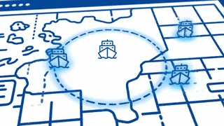
Search for all vessels within any geographic area. Specify coordinates and radius to find ships near ports, in anchorages, or crossing specific zones. Perfect for port monitoring and maritime surveillance.
Terrestrial + Satellite AIS coverage. Satellite results require a satellite plan.
50km
Max Radius
Real-time
Updates
Global
Coverage
99.9%
Uptime
Try It: Select Area on Map
Click anywhere on the map to select coordinates, or enter them manually below
Loading map...
Selected Area: Lat: 51.9, Lon: 4.5, Radius: 25 km
This endpoint returns results from both terrestrial and satellite AIS. Satellite results are only included if your plan includes satellite credits.
Search Parameters & Response Data
Define your search area and receive comprehensive vessel data for every ship in range.
Search Parameters
LatitudeLongitudeCircle Radius (km)
Vessel Identification
MMSIVessel Name
Position Data
LatitudeLongitude
Movement Data
SpeedCourseHeading
API Parameters
Configure your area search with these request parameters.
| Parameter | Type | Required | Description |
|---|---|---|---|
latitude | number | Required | Center latitude coordinate (up to 1 decimal place, e.g., 45.0) |
longitude | number | Required | Center longitude coordinate (up to 1 decimal place, e.g., -9.0) |
circle_radius | number | Required | Search radius in kilometers (maximum 50km) |
Response Fields
Data returned for each vessel in the search results.
vesselsArray of vessels currently within the searched area
mmsiMaritime Mobile Service Identity
nameVessel name from AIS
latitudeCurrent latitude position
longitudeCurrent longitude position
speedSpeed over ground (in tenths of knots)
courseCourse over ground in degrees
headingTrue heading in degrees (may be null)
typeSpecificSpecific vessel type from AIS (e.g., Bulk Carrier, Container Ship, Crude Oil Tanker)
Sample API Response
Example response for vessels within 50km of coordinates (45.0, -9.0).
GET /api/vessels_operations/get-vessels-by-area?latitude=45.0&longitude=-9.0&circle_radius=50
{
  "vessels": [
    {
      "mmsi": "245297000",
      "name": "ELBEBORG",
      "latitude": "45.078705",
      "longitude": "-8.9553804",
      "speed": "110",
      "course": "185",
      "heading": "184",
      "typeSpecific": "Bulk Carrier"
    },
    {
      "mmsi": "205106000",
      "name": "MARCUS",
      "latitude": "45.041",
      "longitude": "-8.8073854",
      "speed": "35",
      "course": "198",
      "heading": null,
      "typeSpecific": "Container Ship"
    },
    {
      "mmsi": "305005300",
      "name": "WANHEIM",
      "latitude": "45.070534",
      "longitude": "-8.8638268",
      "speed": "101",
      "course": "354",
      "heading": "353",
      "typeSpecific": "Crude Oil Tanker"
    }
  ]
}
Use Cases
How maritime organizations use area-based vessel search.
Port Authority Operations
Monitor vessel approaches, manage anchorages, and coordinate traffic in port waters with real-time area awareness.
Commodity Intelligence
Track tanker and bulk carrier activity near loading terminals to gain insights into commodity movements and market trends.
Environmental Monitoring
Monitor vessel traffic in marine protected areas, emission control zones, and sensitive ecosystems for compliance.
Frequently Asked Questions
What is the maximum search radius?
You can search for vessels within up to 50km (approximately 27 nautical miles) of any coordinates. For larger areas, you can make multiple overlapping queries or contact us about custom solutions.
How current are the position updates?
Positions are updated in real-time as AIS signals are received. The endpoint returns results from both terrestrial and satellite AIS — terrestrial is available on all plans and provides updates every few seconds for vessels near shore; satellite results are available on satellite plans and extend coverage to open-ocean vessels.
How do I specify coordinates?
Provide latitude and longitude in decimal degrees format with up to 1 decimal place (e.g., 45.0, -9.0). The API accepts standard WGS84 coordinates used by GPS and most mapping systems.
What data is included for each vessel?
Each vessel in the results includes MMSI, name, position coordinates (latitude/longitude), speed, course, heading, and typeSpecific (the specific vessel type — e.g., Bulk Carrier, Container Ship, Crude Oil Tanker). Speed is returned in tenths of knots. Heading may be null for some vessels.
What is the rate limit?
The Vessels by Area endpoint has a rate limit of 50 requests per minute. This is higher than the standard 15 requests per minute for most other endpoints, allowing for frequent area monitoring.
Related API Endpoints
Explore other maritime data solutions
Start Searching by Area Today
Find vessels in any location with our area search API. Start with a free trial.
Start Free Trial